GeoGraphVis
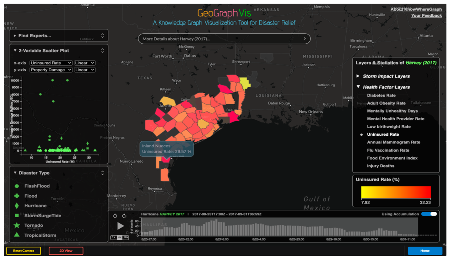
GeoGraphVis is a cutting-edge cyberinfrastructure solution that leverages knowledge graph technology and advanced visualization to support intelligent decision-making and problem-solving. It integrates cross-domain data through a location-aware knowledge graph, making it analytics-ready for complex challenges. By modeling expert-driven disaster response workflows into machine-understandable decision paths, GeoGraphVis guides knowledge exploration and streamlines decision-making. Additionally, its scene-based visualization enables interactive and heuristic visual analytics, providing a clear understanding of disaster impacts and aiding the development of actionable plans for humanitarian aid. Read the paper.
Visualize the socio-economic and health profiles of disaster-affected areas in GeoGraphVis to identify vulnerable populations in need of medical aid.
Collablocation
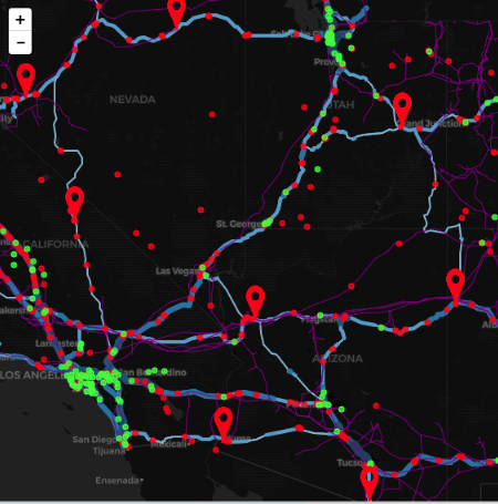
Collablocation is a free, open-source geodesign platform for facility location problems. Collablocation extends geodesign from its roots in land-use planning to facilities such as fuel stations (our first application), schools, fire stations, or virtually anything that can be represented as a set of points on a map.
AFV Routing
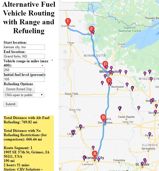
AFVROUTING is a prototype route mapping website that calculates and displays, with a single click, the best driving route given the type of fuel, the available stations, and the vehicle’s driving range. This prototype is for CNG and Hydrogen stations in 2014.